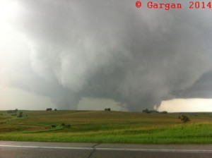
April 23rd:
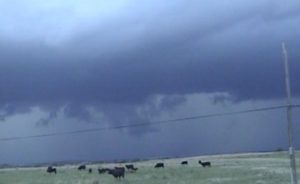
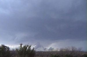
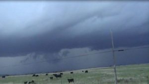
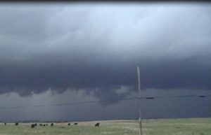
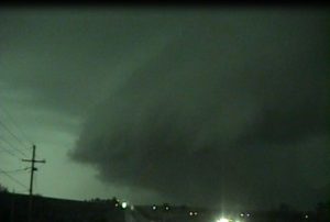
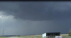
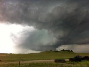
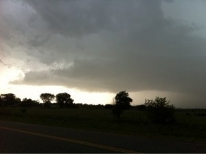
This was my first chase of the 2014. The moisture return was quite marginal. The vertical wind shear was good and I knew there would be a chance for high based supercell thunderstorms. I probably would not have chased Today but decided to when Jared went with me to split chasing costs. Our target area was western and southwest OK. Intercepted a storm along the OK and TX border about 10 miles south-southwest of Erick, OK. The storm was high based but had better structure for a while then what I thought this day could yield. The isolated storm turned into a linear line of broken storms as we followed them northeast until dark and decided to call it quits before going after more storms across southwest OK. (will add a few pictures later).
Supercell: 1
Tornado: 0
Chase partner: Jared Leighton.
Chase route: (will be posted later).
_______________________________________________________________
May 7th:
I was planning on chasing around Topeka but the storm just southwest of Topeka was a big left moving HP storm. I observed some more isolated storms much farther to my southwest and decided to try to catch the tail end storm. I intercepted a tail end storm near Coyville, KS with some structure but it soon became an HP supcell. Another couple updrafts formed farther southwest and before I knew it I found myself down along Highway 400 north of Fall River, KS. Once again the tail end storm had some nice structure but eventually turned into an HP type storm. Called it quits and headed back to Topeka. ( I will add some photos later).
Supercell: 2
Tornado: 0
Chased alone.
Route Map: (will add later).
_______________________________________________________________
May 1oth:
Once again, another day that was lacking deep gulf moisture. There were two target areas this day where I thought the shear and instability would be sufficient for tornadoes. One area was east of Wichita along the dryline but thought moisture would really mix out. Second area was across extreme east central KS along the MO border. I decided on the latter and was about to head east on I-70, then I saw a nice storm explode west of Holton,KS. The convection looked so great, I decided to blow off the storm west of KC and target the Holton storm. The Holton storm was a nice supercell and had a wall cloud that was slowly rotating. Followed the Holton storm east-northeast to Lenvenworth, KS but it became more of an HP so I left it hoping storms wold form farther south. A big left moving supercell hit southeast Topeka with golf ball to baseball size hail. This storm put out a lot of outflow. Meanwhile my original target storm got it’s act together over KC and went on to produce several tornadoes east of the KC metro just south of I-70. ( I may post some pictures later).
Supercell: 1
Tornado: 0
Chase partner: Chased alone.
Chase route: (will post later).
_______________________________________________________________
May 11th:
Finally a day that had deeper gulf moisture in place, moderate to strong vertical windshear and good instability. The best area looked to be along and just south of an outflow boundary/warm front across southeast NE. My target area was northwest of Beatrice, NE. I met up for lunch in Concordia with chaser Sean Lyon. He tagged along with me. Once in Beatrice, the outflow boundary was slowly moving northwest, while a dryline was mixing east across south central NE. A nice triple point was forming near Hastings, NE. Finally a storm went up south of Hastings, but it looked north of outflow boundary but I decided to target this storm in case it move along or east the OFB. I intercepted the storm southeast of Clay Center, NE. The storm had a nice rotating wall cloud with a funnel. Followed this storm northeast and observed a multi-vortex tornado. The tornado was about 5 miles to my northwest and looked rather weak. This storm rapidly became a big HP moose supercell with an intense tornado wrapped up in the rain. I did see the tornado briefly 1 mile southeast of Sutton, NE. I continued to stay ahead of the HP supercell all the way to OMA, where it finally overtook me and I gave up and drove south on US 75, back to Topeka. Actually, it was a disappointing day since the storm stayed just north of the OFB and became a big HP storm with not the greatest structure.
Supercell: 1
Tornadoes: 2
Chase partner: Chased alone. Met up with chaser Sean Lyon at times.
Chase route: (will post later).
_______________________________________________________________
June 5th:
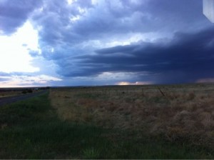
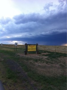
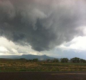
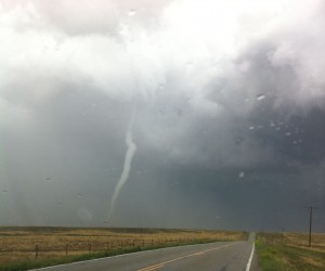
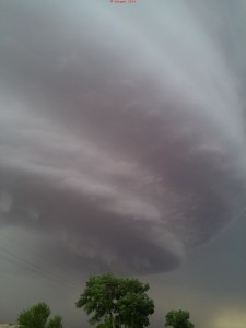
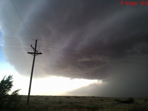
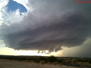
This was the first day of my 12 day annual chase vacation. Following a midnight shift I worked. Nancy and I loaded up the SUV and headed out. My target was northeast NM where residual moisture coincided with moderate vertical wind shear. Upslope flow would cause a isolated high based thunderstorms to develop with some supercell structures possible. We finally did see some storms develop across Southeast CO and played a new storm that developed just inside the NM state line, due west of Boise City, OK. We took some county roads back to intercept the storm. The storm did not look too impressive. We sat and watched if for about an hour, then headed to Raton, NM to spend the night. On the drive to Raton, we did see quite the lightning display from a storm that developed near the Volcano.
Pictures of the 6/5/14 NM storm.
Supercell: 0
Tornado: 0
Chase partner: Chased with Nancy.
Route Map: (will add later).
_______________________________________________________________
June 6th:
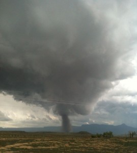
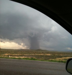
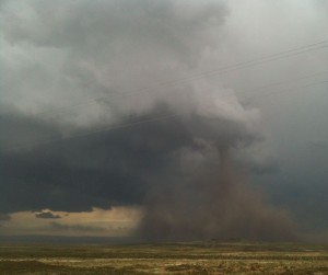
We woke up almost right in our target area for Today. The big question was to play storms coming off the Mountains at Trinidad or remain near Rotan and play a storm that would develop just east on or near the Capuchin Volcano? I did noticed a bit deeper moisture advecting west-northwest across extreme southeast, CO, so I decided to play east of Trinidad, CO. We drove north to Trinidad, CO and had lunch. During our lunch a storm develop on the mountains just west of town. I decided to target this storm and waited for it to come down the mountain. When it did it hit slightly deeper moisture and the base gradually lowered as the storm began to take on supercell structure. Looked at it on radar and the mid-level rotational velocity was increasing. We stayed just ahead of the storm on Highway 160. We found a nice place to pull off the road and began taking pictures and video. Then suddenly the low-level meso(wall cloud) began to rotate more moderately then a funnel formed and I could see debris on the ground. The tornado began to grow in size, so I looked to see if the PUB office had a tornado warning out. They did not, so I called my office in TOP to have John Woynick the forecaster at the TOP office to call the PUB office about the tornado. The tornado took on a dusty stove pipe shape for over half an hour as it moved from our southwest to southeast. We caught up to the tornado but by this time it was a big dusty tube and was very hard to define where the tornado vortex was. Eventually it just dissipated within this big wall of dust. A new wall cloud and funnel formed as the storm had occluded. This funnel touched as the second tornado but was hard to see due to the rain wrapping around it. It passed to our east and northeast and we got to see the white tornado rope out about a mile to our east-northeast. We continued for a mile east on Hwy 160 but the point where the tornado crossed the highway it had snapped a power pole and strewn the electric line and heavy duty barbed wire across the highway. We had to turn around and head all the way west. The police were blocking off southbound 160 back to Trinidad, so we went north on HWY 35o to intercept storms moving southeast from Colorado Springs. These storms died as we headed north from Rocky Ford, CO. We were thinking about going up after a new storm south of Kit Carson,CO but it looked too far a way to catch. We did watch it from a distance and may have seen a land spout from over 50 miles away to the southeast of Kit Carson. Since, I was too far a way to determine if it was a land spout or just RFD dust I will not place it in my tornado count. We headed west to stay the night in PUB.
Supercells: 3
Tornadoes 2
Chase Partner: Nancy.
Chase Route: 6-6-14chase(click to see route).
______________________________________________________________
June 7th:
We started off from PUB, My target was across east central NM, southeast of Las Vegas, NM. We drove down Las Vegas then took HWY 84 southeast towards Santa Rosa, NM where we saw a storm going up about 30 miles south of town. There was no south option so we took 84 southwest to east bound HWY 60. We caught up to the storm but it really looked high based. We watch the slowly moving storm and it did have supercell structure. I noticed a new storm going up to our southwest. Overtime this storm looked more impressive than the one we were on, visually, so I decided to track the storm to our southwest. Once again we had poor south road options. I decided to go south-southeast on on HWY 285 and headed about 10 miles where we stopped to watch the storm about 18 miles to west-northwest. It had a great supercell structure with a nice wall cloud. We saw a funnel drop half way to the ground and debris kicked up under the funnel. This was a brief tornado about 2 miles southeast of Corona, NM. A new updraft form on the southeast flank of the original supercell. The storm developed quick and turned into a nice rotation storm with splendid structure. We followed this storm to the southeast along 285. The storm eventually crossed southeast of 285 about 20 miles north of Roswell, NM. Within the RFD we saw numerous gustnadoes. Some of the gustandoes were almost looked like landspouts due to the fact that the gustnadoes seemed to connect to the bases of the updrafts on the back of the supecell thunderstorm. Eventually we headed south to try to get back in front of the original supercell. Though another supercell developed about 15 miles northwest of Roswell. This storm moved ESE to the north of Roswell. Eventually we decided to get dinner in Roswell and then spent the night there. Overall, this was a great chase with some highly structured supercells!
Supercells: 4
Tornado: 1
Chase partner: Nancy.
Chase Route: 6/7/14 Roswell chase (click here).
____________________________________________________________
June 8th:
We awoke in Roswell. The better mid and upper level flow looked to be across southeast NM. A thunderstorm complex across the TX PNHDL has robbed some of the moisture but mid 50 dewpoints continue to flow west-northwest and upslope would produce isolated thunderstorms. We targeted the Mountains northwest of Roswell. My target was south of Corona. We took Highway 247 to Corona and this Highway was one of the most barren roadways I’ve been down in a while. There were no fences, electric poles or buildings for the first 30 miles. During the drive west we observed our target storm going up. So we headed south out of Corona. The storm was already to our east, so we had to go south to Highway 380, then east until we got out of the mountains and foothills. Eventually we go far enough east to see the entire storm. It gradually drifted southeast to our position about 10 miles west of Roswell. The storm became a big HP blob and lost much of its structure as it passed south of Roswell. New updrafts were forming on the southern flank and these would look nice for a while but merged into the main HP storm and produced a big HP complex of storms. After staying ahead of the complex we noticed a more isolated storm going up by Carlsbad. So we targeted this storm. We got south-southwest of Carlsbad and the storm just exploded with great structure for about 3o minutes. Eventually it became a big HP moose and we decided to have dinner in Carlsbad. Hotels were a lot cheaper in Roswell, so we drove north to spend the the night in Roswell.
Supercells: 2
Tornado: 0
Chase Partner: Nancy.
Chase route: 6/8/14 Carlsbad (click here).
___________________________________________________________
June 13:
We intercepted a nice supercell just northeast of Devils tower. We followed this storm east through some hilly terrain but got back into a flat treeless area as we approached the SD border. By this time the supercell was more of an HP storm but I could see a nice wall cloud on the north side of the horseshoe mesocyclone. I may have seen a tornado to my north but the rainy RFD blocked my view. A few other chasers confirmed a tornado at the same time who were farther northeast of the storm. Since I could not confirm a tornado, I will not count it.
Supercell: 1
Tornado: 0
Chased with Nancy.
_______________________________________________________________
June 14:
Intercepted a supercell west of Central City Watched move east. A second supercell developed farther northeast and we began following the lead supercell that had a nice wall cloud and produced a funnel. Eventually, this storm got seeded by our origanal supercell, then a line of storms developed. We kept driving south but the outflow kept undercutting the tail end updrafts. After sunset we called off the chase and headed back to ICT.
Supercells: 2
Tornado: 0
Chased with Nancy.
_______________________________________________________________
June 15:
Since we stayed the night in ICT at Nancy’s parents house, I decided to chase this marginal day. Forecast soundings showed a fairly stout cap in place and I thought there could be just enough convergence along the dryline and OFB for a storm or two. The vertical wind shear was a bit marginal but deeper moisture advection lead to an increase in MLCAPE of 2 to 3 K j/kg. Nancy and I headed for north central OK. We had dinner west of Perry at the Braum’s off of I-35. We went back up to US60 and waited around watching TCU go up and dissipate to our west and southwest. Finally gave up at before sunset and drove back to Topeka to be ready for the next day.
Supercell: 0
Tornado: 0.
Chase partner: Nancy.
Chase route: Click here!
_______________________________________________________________
June 16:
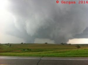
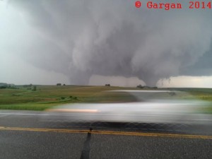
We left Topeka for my initial target of Northeast NE. This day had plenty of instability and vertical windshear for tornadic supercells and some of the tornadoes could be significant. We had lunch and a data stop at Sioux City, IA. The winds were quite strong from the southeast, upwards of 40 MPH with some gusts up to 50 MPH. Elevated storms were already moving north and east of town and I knew some of these storms would soon become boundary rooted and turn into surface based supercells. I noticed an OFB moving north across central and eastern NE and thought the boundary would move to the SD border by late afternoon. The two versions of the WRF, advanced research and non-hydrostatic were forecasting the CAP to increase and that no storms my form along the OFB within the warm sector, with the only storms staying north across SD and MN. We drove up into extreme southeast SD at Beardsford for another data stop. Here I anlyzed the OFB extending from east of Norfolk, west-northwest to west of O’Neil. My thoughts was that a storm would go up west of O’Neil, so I was heading west on HWY 46 to HWY 81. I also wanted to stay north in case the tail end of a QLCS would become a tornadic supercell and did not want to stay too far south. As we were driving, my wife alerted me that a cell was going up south of Norfolk. I sopped the car and realized this storm was developing right on the OFB. The parameters of CAPE and 0-1KM SRH were off the chart, in fact the effective tornado parameter was at 13 and 14 units across northeast NE. I decided to target this developing storm, so we headed back to I-29 and went south to Highway 50, then west to HWY 19, then south across the Missouri river into NE. We headed south to Wayne and had to make a decision to head east out of Wayne then drop south ahead of the storm or drop south on the back side of the supercell. I decided to head south since the large hail core was east of HWY 15. We got about 7 miles south of Wayne and came out of the rain to see a rather large tornado developing to our southeast. Then as we drove a mile farther south I could see another large tornado about 2 miles to my east. We stopped the car and took pictures and videos of two large tornadoes. The northern tornado was the one that moved through Pilger and was occluded and the second tornado was the new Meso on the southeast flank of the supercell. This was the first time where I observed two violent half mile wide tornadoes simultaneously. Usually the first occluded tornado weakens and begins to rope out while the new mesocylcone tornado intensifies. We headed south to try to get ahead of these tornadoes. I did not realize that the tornadoes began to move with more of a northerly direction until I had turned on to US 275. We could see the path the southeast tornado had carved through a cattle ranch. We headed east on Highway 51 and watched the 2nd tornado rope out as it got absorbed into the new large tornado developing. The wrap around rain core kept us from seeing what happened to the Pilger tornado. It may has dissipated or roped out while being shielded by the rain core. We headed north of HWY 9 in order to catch the tornado but it became hidden behind rain curtains. When we got to HWY 35, we followed it northeast while a new wall cloud was forming just to our southeast. We stayed ahead of the rotating wall cloud and saw a few funnels that never seem to touch the ground. We watched the storm updraft move northeast across HWY 35, just to our west. A few minutes later we observed a brief tornado that lasted for only couple minutes. During this time the supecell took on an LP appearance and look to have the best structure. As the storm approached Sioux City if dissipated (lucky for them). We headed back south on I-29 and if a storm were to develop west of OMA we would intercept it. Nothing went up farther south so we had dinner and drove back to Topeka. This was my best 6/16 chase day. 22 years ago I suffered one of my worse busts missing out on large tornadoes across southeast SD and southwest MN (6/16/92). The town of Chandler, MN got hit on 6/16 back 1992.
Supercell: 1
Tornadoes: 4
Chase Partner: Nancy.
Chase Route: 6/16/14 Pilger (click here).
__________________________________________
Supercells: 13 Tornadoes: 9
Bill’s count: 162.

