May 1:
Good veritcal wind shear and instability was forecasted ahead of the dryline across the southeast TX Panhandle. The storms went up and look like they would be good supercells but the two we chased were outflow dominate. We followed the tail end storm into southwest OK.
Supercell: 2
Torando: 0
Chased with Jon Finch and Dave Hodges.
_______________________________________________________________
May 18:
This day had strong vertical windshear but marginal moisture return. Got on a supercell that became outflow dominate north of Kankakee, IL and tried to follow it into northwest IN but it was moving at 50 MPH, so decided to call it quits.
Supercells: 1
Tornado: 0
Chased along.
_______________________________________________________________
May 23:
This day had weak flow at 300 mb with good instability west central KS. I got on an HP supercell in Jewell County KS and followed it east to north of Concordia.
Supercells: 1
Torando: 0
Chased with David Gold and Carl Schultz.
_______________________________________________________________
May 24:
Chased northeast CO with good low-level vetical windshear and moderate instability. Got on a nice supercell southwest of Limon, CO and followed it northeast it. It went east of an outflow boundary and became an HP supercell.
Supercell: 1
Tornado: 0
Chased with David Gold and Carl Schultz.
_______________________________________________________________
May 25:
This looked like a good day with strong vertical windshear and moderate instability. We go on a nice supercell near Kingman, KS and followed it east. We were taking dirt roads to keep up with the mesocyclone but one stretch of road said the road was closed due to bridge construction, so we had to detour 10 miles south and 10 miles east before we could catch this storm. Unfortunately, the supercell produced a nice tornado near Perth, KS. Some other chasers ignore the closed road sign and were able to see the tornado, since the road was not closed. By the time we got on the supercell northwest of Arkansas City, it was a big HP mess, so we went back to Norman.
Supercell: 1
Tornado: 0
Chased with David Gold and Carl Schultz.
_______________________________________________________________
May 26:
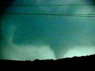
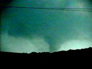
A great set up ahead of the dryline across eastern OK where mid 70 dewpoints returned and a 50 KT jet max at 500mb moved across northeast OK. We got on a supercell southwest of Tulsa and the storm produced a nice tornado south Sapulpa, OK. We got on another supercell farther south along the dryline but it never produced a tornado.
Supercells: 2
Tornado: 1
Chased with David Gold and Carl Schultz.
_______________________________________________________________
May 28:
There was good vertical windshear and moderate CAPE ahead of the dryline across the TX PNHDL. I got on a supercell thunderstorm west of Stafford. It was a classic storm but the wall cloud kept occluding fast. Eventually it became an HP storm.
Supercell: 1
Torando: 0
Chased alone
_______________________________________________________________
June 2:
Played dryline across southwest KS and the OK Panhandle. Upper flow may have been a bit too weak (40 KTS) and may have been the reason a nice supercell went quickly to an HP supercell west of Boise City, OK.
Supercell: 1
Tornado: 0
Chased alone
_______________________________________________________________
June 11:
This was the official first chase by Silver Lining Tours. We had one paying customer, Ed (forgot his last name) from Little Rock, AR. We played the triple point near Liberal, KS. No storm went up but we were watching a great supercell well to our south that produced a nice tornado near Shamrock, TX.
Supercell: 0
Tornado: 0
Chased with David Gold and Ed.
_______________________________________________________________
June 12:
Day 2 of SLTs first tour. We chased a high based supercell in the eastern TX Panhandle, south of Canadian, TX.
Supercell: 1
Tornado: 0
Chased with David Gold and Ed.
_______________________________________________________________
June 13:
Day 3 of SLT. We got on a nice supercell with a rotating wall cloud west of Paris, TX. The storm came close to producing a tornado but the low-level meso kept occluding too fast.
Supercell: 1
Tornado: 0
Chased with David Gold and Ed.
_______________________________________________________________
June 14:
Day 4 of SLT: Eastern CO look good for supercells. Moisture return may have been a bit too slowl W got on a nice supercell thunderstorm north of Limon. This storm died once it move east down in elevation.
Supercell: 1
Tornado: 0
Chased with David Gold and Ed.
_______________________________________________________________
June 15:
Day 5 of SLT. There was a chance for supercells across east central Kansas near Topeka. However, the CAP was too strong and we did not get a storm to form along the surface dryline. We were telling Ed how we wished it was 5 years earlier where David and I saw a great supercell complex and several tornadoes in 1992.
Supercell: 0
Torando: 0
Chased with David Gold and Ed.
_______________________________________________________________
June 16:
Day 6 of the inaugural SLT, our last chase day. We took our chances and played the dryline in the jungles of eastern OK. We got on a nice supercell that came close to producing a tornado near Lake Eufula, OK.
Supercell: 0
Tornado: 0
Chased with David Gold and Ed.
_______________________________________________________________
June 29:
Chased dryline across northwest OK. The upper flow was weak but the instability was very high. Got on an HP supercell near Woodward, OK and followed it east for an hour. Missed a tornadic supercell up near Wichita, KS.
Supercell: 1
Tornado: 0
Chased alone.
_______________________________________________________________
June 30:
Nice upper trough was moving into the northern high plains. Got on a nice structured supercell that morphed into an HP supercell but had excellent structure. Followed this storm from southeast of Valentine, NE east for about 100 miles. This may have been my best supercell structure of the year.
Supercell: 1
Tornado: 0
Chased alone.
_______________________________________________________________
July 1:
Excellent vertical windshear and instability across southeast SD and southwest MN created a favorable environment for large damaging tornadoes. SPC had a high risk out for this area as well. David Gold and two of his friends from TAM drove up and we met up in Sioux City, IA to chase together. We headed north into southeast SD and then east on I-90. Mid level clouds increased and we thought moisture advection was too strong at 700mb. The cloud cover messed everything up. Near sunset storms developed in northwest IA along the dryline. A few of these storms we sampled and they had wall clouds but looked elevated and were moving very fast, 50 MPH or greater. Overall this was one of my biggest busts!
Supercell: 2
Tornado: 0
Chased with David Gold and two of his friends from TAM.
_______________________________________________________________
Supercells: 17
Tornadoes: 1
Bill’s count: 58.


