March 26:
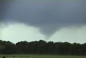
This day had moderate vertical windshear and low CAPE ahead of the dryline. Intercepted an HP supercell west of Decatur, TX and followed it east to FTW, then left for Norman.
Supercell: 1
Tornado: 0
Chased with: Paul Robinson
_______________________________________________________________
April 2:
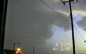
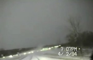
This day had decent vertical windshear. Moisture return was a bit slow but there was a nice supercell that developed 4 miles west-northwest of Ada, OK. Just west of Ada the storm had a weakly rotating wall cloud. Got a couple inches of hail with some half dollar size hail mixed in on the east side of Ada.
Supercell: 1
Torando: 0
Chased alone.
_______________________________________________________________
April 9:
My first chase with VORTEX-94 in probe-1 and Bob D-J. Looked like a great day with high CAPE and good vertical windshear. The warm sector was capped and finally a storm went up along the triple point and moved east-northeast to the north of the surface warm front. We intercepted the updraft that had a long inflow tail feeding into the updraft. As we got closer the updraft became wrapped in rain and we noted weak rotation. We followed the storm for 20 minutes then the FC called off operations.
Supercell: 1
Tornado: 0
Chased with: Bob D-J in probe 1 during V-94.
_______________________________________________________________
April 10:
Good mid to upper level flow. The surface pattern was weak and southerly surface winds were only 10 KTS. Sat around south of Ada, OK and watched CU go up along the dryline. A storm did not initiate.
Supercell: 0
Tornado: 0
Chased with: Bob D-J in prob1 during V-94.
_______________________________________________________________
April 14:
A tight dryline mixed east into central OK. The warm sector ahead of the dryline had high CAPE and moderate to strong vertical windshear. Vortex-94 made several passes across the dryline around the OKC metro. The cap never broke and it was a short drive back to NSSL.
Supercell: 0
Tornado: 0
Chased with: Bob D-J in probe 1 during V-94.
_______________________________________________________________
April 25:
Great set up ahead of a negative tilt upper trough lifting northeast into the central and southern high plains. Two high based squall lines developed across western OK and moved east across central and southern OK. VORTEX decided to play central OK and was hoping the atmosphere would recover by late afternoon. Meanwhile, down in north TX west of FTW here was a tornadic supercell.
Supercell: 0
Tornado: 0
_______________________________________________________________
April 26:
VORTEX decided to target an elevated storm northeast of Ardmore, OK. The armada moved northeast to collect data on this storm. Meanwhile, a supercell developed northwest of Gainesville and produced a tornado just north of town. By the time VORTEX got down to the supercell northeast of Gainsville, it had transitioned into an HP supercell. Operations were soon called off and we headed back to NSSL. I was a bit disappointed that we stayed on an elevated storm so long when the environment just south of the Red River was so much more favorable.
Supercells: 2
Tornado: 0
Chased with: Bob D-J in probe 1 with V-94.
_______________________________________________________________
April 27:
Another day with an upper trough lifting northeast across the high plains. The warm sector across north Texas had high CAPE and good vertical windshear. However, the CAP never broke. VORTEX just moved back and forth along the dryline near Mineral Wells, TX.
Supercell: 0
Tornado: 0
Chased with: Bob D-J in probe 1 with V-94.
_______________________________________________________________
May 6:
This day had moderate CAPE and vertical windshear ahead of the dryline in central OK. The CAP look quite strong but there was just enough convergence for a storm to develop near Ponca City. We followed it east across Kaw Lake and to Fairfax. There was a rotating wall cloud but we never did see a tornado, even though one was reported with the storm near Kaw Lake.
Supercell: 1
Tornado: 0
Chased with: Bob D-J in probe 1 with V-94.
_______________________________________________________________
May 9:
We targeted the dryline bulge in the TX PNHDL. The deep moisture never made it as far northwest to the central and northern TX PNHDL. We played southeast of AMA along the Paladoro Canyon, hoping the CAP would break but there was no cap rock magic this afternoon. A nice supercell went up along the triple point near Dalhart and produced large hail.
Supercell: 0
Tornado: 0
Chased with: Bob D-J in probe 1 with V-94.
_______________________________________________________________
May 13:
This day had weak shear with moderate instability. We watched a high based storm develop northwest of CDS. Soon, several updrafts went up and produced a grungy squall line that moved east across western OK and northern TX.
Supercell: 0
Tornado: 0
Chased with: Bob D-J in probe 1 with V-94.
_______________________________________________________________
May 24:
Upper flow was beginning to strengthen but overall the vertical windshear was weak. Deeper moisture was beginning to return to north TX. We got on a storm that formed west of SPS along the dryline. The storm intensified and had a rapidly rotating wall cloud east of SPS but could not produce a tornado. The storm weakened as it move north of the Red River.
Supercell: 1
Tornado: 0
Chased with: Bob D-J in probe 1 with V-94.
______________________________________________________________
May 25:
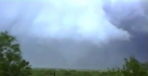
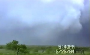
The zonal flow increased across the Panhandle. The dryline mixed to the edge of the cap rock. A supercell formed northwest of Northfield, TX. The supercell moved east and produced a tornado that lasted for around 45 minutes. The tornado was rain wrapped at times. A second supercell form near Vernon, TX and we saw a rotation wall cloudy near sunset.
Supercell: 2
Tornado: 1
Chased with: Bob D-J in probe 1 with V-94.
_______________________________________________________________
May 26:
Moderate vertical windshear and MLCAPE of 1200-1800 J/kg allowed for a few supercells to develop along the dryline across west TX. D-J and I took back FM roads to get to a splitting storm rather quickly. When Erick asked for our coordinates we could hear both him and Jerry laughing in the FC van. The left split looked good and seem to be close to producing an anti-cyclonic tornado. The right mover became nearly stationary northwest of LBB and was high bases and more outflow dominate. It almost looked like it was right moving southwest into drier air.
Supercells: 2
Torando: 1
Chased with: Bob D-J in probe 1 with V-94.
_______________________________________________________________
May 29:
This day had good vertical windshear and instability. We intercepted an intense supercell updraft north of Graham, TX. The wall cloud was really rotation. To our southwest another updraft went up along the flank of our storm, then produced a large tornado that stayed on the ground for several minutes. The view to our southwest obscured by the core of the new storm. The P-3 plane was watching the tornado from start to finish but never told the FC about the tornado. A few chasers were farther southwest of more intense updraft north of Graham and got to see the big stove pipe.
Supercells: 2
Tornado: 0
Chased with: Bob D-J in probe 1 with V-94.
_______________________________________________________________
May 31:
Weak shear and moderate instability caused high based storms to develop across southwest KS. We started looking for landspouts under the weak updrafts. This must of been just a travel for VORTEX-94 to set up for the next day across western KS.
Supercell: 0
Tornado: 0
Chased with: Bob D-J in probe 1 with V-94.
_____________________________________________________________
June 1:
Weak upper level flow lead to outflow HP storms despite good instability. VORTEX chased north central KS and observed 3 HP supercell type storms. We ended up following one of the better organized HP supercells to Heberon, NE.
Supercells: 3
Tornado: 0
Chased with: Bob D-J in probe 1 with V-94.
_______________________________________________________________
June 7:
VORTEX did not leave early enough to make the northwest KS target where moderate vertical windshear and high instability allowed an environment favorable for tornadic supercells. Instead VORTEX played the dryline across northwest OK that remain capped the entire afternoon and evening. The teams just transverse the dryline hoping a storm would pop.
Supercell: 0
Tornado: 0
Chased with: Bob D-J in probe 1 with V-94.
_______________________________________________________________
June 8:
VORTEX had targeted the dryline across western KS but the CAP was so strong that VORTEX called called off operations when we reached northwest OK during the early afternoon hours. We turned around and went back to our base at NSSL. Torndic supercells developed across northeast CO. I doubt the armada would have made it in time.
Supercell: 0
Tornado: 0
Chased with: Bob D-J in probe 1 with V-94.
_______________________________________________________________
June 10:
This day had moderate vertical windshear and moderate instability. VORTEX went to play the dryline near Dalhart, TX. The moisture began to mix out, so we headed southeast towards AMA. A storm went up on the west edge of the deep moisture southwest of AMA. It had a rotating wall cloud near Wildorado, TX, then quickly became an ouflow dominated HP supercell.
Supercell: 0
Tornado: 0
Chased with: Bob D-J in probe 1 with V-94.
_______________________________________________________________
June 29:
This was a weak shear high CAPE day. Thought I could get a storm that went up along the dryline in northwest OK that would initially develop as a classic supercell. The storms were all outflow with one HP supcell south of Woodward. A squall line developed and I left home for Norman.
Supercell: 1
Tornado: 0
Chased alone.
_______________________________________________________________
August 17:
This was a northwest flow day with moderate to high CAPE. Intercepted a supercell west of Enid, OK thtat right moved south-southeast. The supercell became a big HP storm. I got some gulf ball size hail north of Union City.
Supercell: 1
Tornado: 0
Chased alone.
______________________________________________________________
October 6:
Looked like a big day for eastern CO. Good vertical windshear and upslope flow. Watched a supercell develop near Lamar, CO then it moved north of La Junta, CO where dissipated after it moved 10 miles to the east. This storm had nice structure. Sean did not want to head farther north because he had a quiz the next day so we missed out seeing a nice tornado east of Limon.
Supercell: 1
Tornado: 0
Chased with: Jon Finch and Sean Lyon.
_______________________________________________________________
October 7:
Upper trough lifted much farther north causing low-level winds to veer a bit across eastern NE. We got on two supercell ahead of the dryline in southeast NE, and saw a funnel cloud near Tecumseh, NE.
Supercells: 2
tornado: 0
Chased with: Jon Finch.
_______________________________________________________________
October 16:
Played the dryline in northwest TX. Vertical windshear and CAPE would support tornadic supercells. However, the CAP was strong and one storm went up near Benjamin, TX after dark. We watched it for a while then drove back to Norman.
Supercell: 1
Tornado: 0
Chased with: Jon Finch and Sean Lyon.
_______________________________________________________________
October 17:
There was lot of overnight convection but skies cleared ahead of the dryline across western OK. We target a storm near Aline, OK and as we approached we saw a stout stove pipe that lasted only 1 minutes. We were about 10 miles east of this tornado. A second storm has this big shelf cloud with a rotating wall cloud in the center. This second storm produced a tornado 3 miles northwest of Fairfield, OK tornado.
Supercells: 2
Tornadoes: 2
Chased with: Jon Finch and Steve Weyegandt.
____________________________________________________________
November 3:
There were two targets this day, one in northeast OK and the second in north TX. We picked the northeast target so that we could attend David Shellbergs memorial service. The storms that went up southwest of Tulsa were big HP storms and we left them driving back to Norman, hoping to intercept better storms. We did make it back in time to attend the memorial.
Supercells:1
Tornadoes: 0
Chased with: Jon Finch and Sean Lyon.
_______________________________________________________________
November 4:
Drove down to Abilene to play dryline. The convergence and ascent was too strong ahead of pacific front and a squall line developed. We followed the squall line northeast and the southern portions became a supercell south of Wichita Falls. We could see a wall cloud but no tornado.
Supercell: 1
Tornado: 0
Chased with: Jon Finch and Sean Lyon.
_______________________________________________________________
November 12:
Left during the night to chase elevated storms across southwest OK and north Texas on our way down to Midland to play the dryline the next day. A few of the storms looked interesting but these were not supercells.
Supercell: 0
Tornado: 0
Chased with Jon Finch and Sean Lyon.
_______________________________________________________________
November 13:
Good vertical windshear and instability developed across west central TX. However, a squall line devloped along the pacific front and moved northeast across north TX. The tail end stormwas a supercell that produced a nice rotating wall cloud northeast of Burk Burnett, TX after dark. We followed this storm into southern OK where it became more elevated.
Supercell: 1
Torando: 0
Chased with Jon Finch and Sean Lyon.
_______________________________________________________________
November 27:
We left in the evening catching up to the dryline on I-40 east of Shawnee. Our plan was to follow the dryline east into eastern AR and chase during the next afternoon. However, Sean and Jon had second thoughts and did not want to chase, so we turned around headed back to Norman. Good vertical windshear and instability ahead of the dryline the next day allowed for good tornadic supercell to develop and move northeast. The tornadoes did F-3 damage near Memphis. One large tornado stayed on the ground for an hour across northeast AR. We should have kept going!
Supercell: 0
Tornado: 0
_____________________________________________
Supercells: 27
Tornadoes: 4
Bill’s count: 33.

