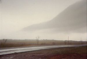
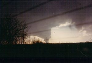
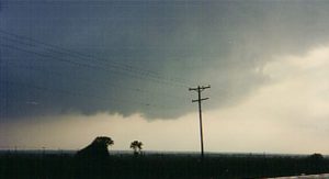
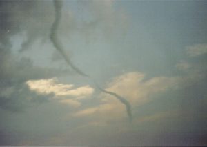
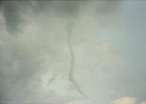
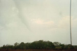
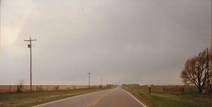
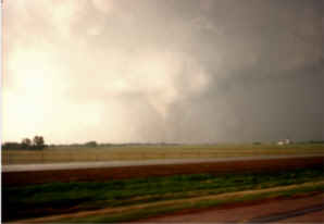
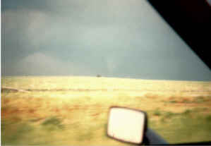
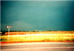
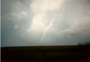
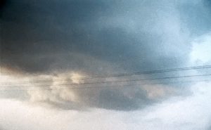
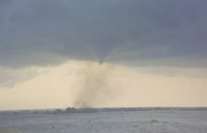
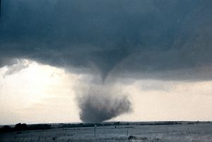
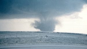
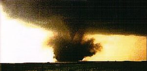
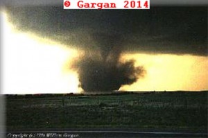
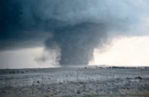
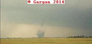
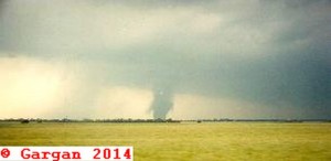
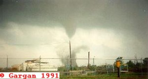
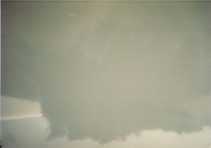
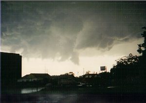
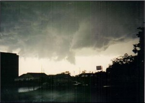
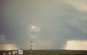
March 21, 1991. This was my first storm chase in the plains! I had a morning courses and then had a meeting with my adviser. By the time I got up to the Map Room it was 3 PM and the Doppler radar display was showing a large hook echo with confirm tornado moving across I-35 south of Pauls Valley. I decided to head east on highway 9 to intercept this storm as it moved north-northeast. By the time I caught up with the storm northwest of Holdenville, the storm looked all HP and I could not see the base of the updraft. The storm was moving into the jungle of eastern OK, so I decided to call it quits and head back to Norman.
Number of Supercell: 1.
Tornado: 0
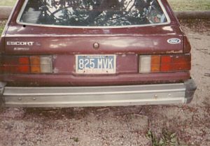
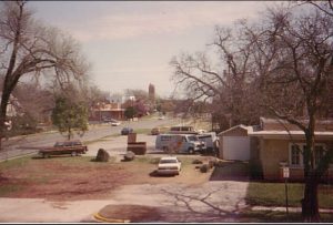
Chased on my own. Before heading out on my first chase, I took a picture of my first chase mobile and out the window of my apartment.
_______________________________________________________________
March 26, 1991. An upper level trough all the models at the time were showing to be missed time ejected out into the southern plains about 6 hours earlier. After a graduate level class at 330 PM CDT, I headed over to the map room to see if anything was worth chasing. When I logged on to METGEM I saw nice dryline moving into western OK with ample CAPE and vertical windshear ahead of the dryline. Satellite photos were showing TCU developing across western and northwest OK. Here, I met up with David Gold who was taking an advance calculus class with me. He wanted to know if I wanted to tag along and I said sure! I tagged along with David and his friend Sean Lyon. We took David’s car and I was designated the navigator and Sean was suppose to take pictures.
We peeled out of the OU campus and headed up the northwest passage to Ceiling where we intercepted a developing supercell thunderstorm. I was pretty much clueless since all my chasing before never involved supercell thunderstorms in Michigan. I was trying to make out features that David was ratteling off and really got lost. This affect my navigation since I thought we were headed north but fount out we were going east away from the storm. David got upset and I agreed it was time to buckle down and pay attention to navigation. I was able to plot the path of the supercell and an interception southwest of Enid, OK on a county road. David did not seem to trust me and said this better work or we’ll never chase again. Well, it did work as we blasted north up the county road the updraft base of the storm came in view. As we got closer a rather large tornado was on the ground 2 to 3 miles to our north. We got out watch the large tornado pass in front of us. Even though it was night, we had a full moon and plenty of lightning to illuminate the large tornado. We even saw the debris fan around the tornado. David and started jumping, hollering and hugging each other. We headed north to Highway 60 the east to I-35, then north to intercept the tornado. We stopped for gas at Blackwell and could see a big cone tornado our west-northwest. After gassing up we continued north where we saw the tornado rope out about a mile to our northwest before it crossed I-35. We could see the new occluded wall cloud just east of I-35 near Bremen. When we just got north of the state border and into KS we stopped as a large stovepipe tornado formed about 2 miles to our east. We sat and watch the tornado continue to grow in size as it moved off to the northeast. Sean complained about taking a calculus II exam in the morning, so we headed back to Norman.
Overall, this chase will stick with me forever. It was my first tornado observed and David and myself formed a great friendship that lasts through Today. We have been chase partner ever since and even formed a chase tour company together, called Silver Lining Tours. Recently, due to family commitments David no longer gets to chase much, but we try to get to chase together once a year. Since 2008, Nancy, my wife has been my full time chase partner.
We have no pictures from this day, since Sean Lyon used up all his film early in the chase so we did not get any nighttime tornado pictures.
Number of supercell observed: 1
Number of tornadoes observed: 2
Chase Route: Click Here.
Chase Partners: David Gold and Sean Lyon.
_______________________________________________________________
April 2, 1991. Both David and I had classes into the early afternoon hours. A nice upper trough was moving east into west TX. The dryline extended south from a surface front across west central OK into north central TX. A nice storm formed on the dryline west of Wichita Falls, TX and moved northeast into southwest OK and south central OK. We tried to get there but missed out on a tornado near Comanche, OK. We got on the supercell near Elmore City, OK and ran into some golf ball size hail.
Number of supercells: 1
Chase Partners: David Gold.
______________________________________________________________
April 11, 1991. Rented a car with some undergraduate students from OU. There was a nice upper trough across the southwestern US and good southwesterly flow at mid-levels. We tried to get out to the Panhandle but left too late to make it to the dryline. We missed some good tornadoes east of AMA. A line of storms developed in western OK, so we turned around and went back to Norman.
Supercells: 0
Tornado: 0
Chase Partners: Gary McMannis, Steve Cobb and Nathan.
_______________________________________________________________
April 12, 1991. An intense upper level trough was lifting northeast across the southern high plains. A dryline was moving east across western OK. There was a weak warm front/outflow boundary across northern OK. My forecast area was along the triple point near Enid. However, as Paul and I were traveling north we noticed a nice updraft going up northwest of OKC and thought the environment was good enough for tornadoes with this storm. So, I decided to give up on my initial target to see a good storm and tornadoes closer to home. We intercepted the slow moving storm east of Hennessey, OK. It has really nice structure but the l0w-level meso cyclone kept occluding. Finally a rope tornado formed just south of Marshall, OK. It was very photogenic and I wish I had a better camera for both storm structure and the nice rope tornado. The storm started weakening while it moved towards I-35. We decided to end the chase and head back to Norma near sunset. Meanwhile, up near my original forecast area, several chasers and Howey’s radar crew caught several nice tornadoes from near Nash, OK to Pond Creek, OK.
Supercell: 1
Tornado: 1
Chase Partner: Paul Robinson.
________________________________________________________________
April 26, 1991. I remember the old MRF model, grandfather to the current GFS, actually showed this outbreak of severe thunderstorms 10 days out. Of course the solution changed but then got on track with the old ETA model. Both showed a huge negative tilt trough lifting northeast across the plains. The GOM was wide opened and mid 60 dewpoints were streaming northward into central KS during the night of April 25. In fact a supercell thunderstorm, elevated at time, tracked northeast across central and eastern KS through IA.
This day I had a class that went through 230 PM. I wanted to chase with David Gold but he was long gone! I raced up to the maproom to see the latest surface map on METGEM. The dryline had already moved east into west central OK. It looked like several targets along the drlyline from central KS, just west of of I-35 corridor, may be even just west of OUN. I decided to chase north central OK along the dryline. I was going to chase along but was chatting to Jeff Evans who said he would like to chase with me. S
So off we go to somewhere north of Enid. As we were driving north we saw some towers going up in the distant west as we were heading north. We knew this area of fresh TCU’s would develop into a storm and head into our forecast area.
As we drove north of Guthrie, OK we could see the developing storm somewhere north of Wotanga, OK. We decided to head west on Highway 52, started getting closer and noticed the storm was just northwest of our position, so we took HWY 132 north. About 8 miles north on HWY 132 we passed under the wall cloud. we noted some moderate rotation. We then took some side roads into western Enid. After turning east on HWY 412, we saw a tornado to our South-southeast. The tornado started crossing north of HWY 412 east of Enid. We stopped 5 miles east of Enid to watch the first tornado rope out. A second wall cloud formed to our northeast and we watch this wall cloud produce some funnel clouds. We didn’t realize that a much stronger wall cloud was developing about 4 miles northeast of our position. We tried taking some county roads and ended up getting lost. We could see a very poor contrast large tornado which was just west of I-35. Our road came to an end so we had to blast south to 412, the east on to I-35. The storm was east of the I-35 by the time we caught up to it. We could not see the large tornado but we did notice the damage path across I-35. There was one house on the left side of I-35 that had 3 of its walls down. We decided to had north and then east to get ahead of the tornadic supercell.
We finally caught up with the Red Rock tornado as it was roping out about 7 miles northwest of Pawhuska. After watching the rope out we decided to try to intercept a tailend supercell that was east of Stillwater, OK. We headed down HWY 11 and punched the core north of Skyatook, OK. We were in a heavily wooded area and could not see a thing, we noticed a cyclonic ground circulation that we drove through. Once we got into a clearing we stopped and looked to our northeast. Lightning illuminated a wall cloud just to our northeast. A first responder drove up to us and asked if we were OK. We said yes and they drove northward. We took HWY 69 north-northeast to try to catch the tornadic supercell. We could see a big barrel updraft illuminated in the lightning. As we approach Oolagah, OK we could see a low wall cloud but not the tornado. As we got to the southwest side of town we were stopped by a state trooper who said the tornado knocked high voltage lines across the road. He took us through this circle detour around a High School that was hit hard. There were buses tossed all around the gymnasium roof had collapsed. Finally we told the officer he was sending people in circles around the damaged High School, he then let us take HWY 88 south to I-44. Since the storm was so far off to our northeast we decided to call it day and head back to Norman. On the way back we drove through a squall line with 50 to 60 MPH winds and quarter size hail.
Number of tornadoes observed: 2 from one supercell.
Number of supercells observed: 2.
Chase partner: Jeff Evans.
Chase route: Click here.
_______________________________________________________________
May 3, 1991. Chased southern OK, along an OFB and dryline moving east into southwest OK and north TX. A storm tried to go up west of Ardmore, OK but the CAP was too strong. This turned out to be a big bust.
Supercell: 0
Tornado: 0
Chase partners: David Gold and Paul Robinson.
_______________________________________________________________
May 4, 1991. The upper trough continued across the southwest US with moderate southwest flow at mid and upper levels across the southern plains. The dryline once again pushed east into western OK. Intercepted a nice supercell near Comanchee, OK and followed it to the northeast. The wall cloud was rapidly rotating near Elmore City and almost produced a tornado before the storm became HP and outflow dominated as it moved northeast to Pauls Valley, OK. We left the storm and headed back to Norman, OK. There was a tornado reported 2 miles south-southwest of Elmore City but we could not confirm this report. Trees may have blocked our view as the funnel cloud was rotating rapidly.
Supercell: 1
Tornado: 0
Chase Partners: David Gold and Paul Robinson.
_______________________________________________________________
May 5, 1991. The main upper trough was lifting northeast across the southern high plains on this day. However there was too much forcing and not enough CAP and a squall line rapidly developed across the eastern TX PNHLD and moved east into western OK. We reached the squall line near Fort Sill, OK. We then stayed ahead of it, hoping an isolated storm may develop ahead of the line. It never happened we drove back to Norman.
_______________________________________________________________
May 11, 1991. Chased with my Brother this day, it was his first and last chase. I missed the big tornado outbreak of May 10th across the TX PNHDL, since my Parents and my Brother were visiting me in Norman. This day had a lot of promise even though the upper level winds were weaker. We drove out I-40 to AMA and watched a storm go up to our southwest. We intercepted the storm southwest of Kress, TX. The RFD filled with rain and the rotating wall cloud became obscured. Following behind it we saw debris strewn northeast of Kress. Most of it was from small farm buildings and probably a rain-wrapped tornado had occurred. We followed the storm but it had transformed into an HP supercell as it tracked south of AMA. After the storm we went through Plainview, TX where my Brother had finished his final year of medical school the previous year. We stopped by his favorite burger joint for dinner, then had the long drive back to Norman.
Supercell: 1
Tornado: 0
Chase Partner: Ken Gargan
_______________________________________________________________
May 12, 1991:
This day looked marginal due to the cap but a nice dryline was going to mix east into the eastern TX Panhandle. I drove to Shamrock, TX and hung around watching some TCU going up to my northwest and west. One storm came close to breaking the CAP but got shredded apart, so I left back to Norman. As I got off on to the I-240 exit ramp from I-40, I noticed the engine check light came on, and then the temperature gage went up rapidly, I turned off the engine and coasted down the exit ramp and had enough momentum to coast into a gas station. I told the owner if I could keep the car here until I could get a tow-truck to tow it to a auto repair shop and he agreed. The water pump actually went out. I had to call a taxi to get back home to Norman.
Chased alone.
No storms.
__________________________________________________________
May 15, 1991:
I had a morning meeting with my adviser during the morning hours. The water pump on my car went out a few days earlier and the gas station owner said he was going to call the city to tow my car away, so I had to find a mechanic to work on it, and took a bus up to OKC, called a tow truck to tow my car to a mechanic a few miles away, then take a bus back to Norman, so I had no vehicle to chase in. I went up to the map room but everyone had left chasing. I knew my friend and chase partner, David Gold, had left earlier in the afternoon. Once in the map room, I found that the upper level trough was lifting out of NM into the TX PNHDL. This was faster than what the models were showing at 12Z. I knew the cap would break along the dryline in the eastern TX PNHLD and the environment ahead of the dryline had good vertical windshear and instability. Keith Brewster did not plan to chase this day. He was showing me gempak plots of moisture flux convergence. The larger bulls-eyes were on the north side of a dryline bulge across northwest OK between 22Z and 00Z. I was ready just to sit and watch events unfold in the map room and give surface obs to any chasers who called. Then an undergraduate student that I had seen before walked in the map-room. I asked him if he wanted to go chasing and he said yes, I asked if he had a car we could use and he said yes. So we drove to northwest OK about 5 miles west of Laverne and watch TCU going up along the dryline to our west. A storm developed to our west-southwest across the TXPNHDL, along the dryline, It weakened and fell a part as it moved towards us. To my south I could see a huge storm exploding down along I-40 but thought we would be too late getting down to it. So we watched our decaying storm. Then all of a sudden hard convection started going up along the first storms flanking line. These towers looked rock hard and a new updraft formed about 10 miles to our west. This storm began to rotate and a lowering developed just to our west-northwest. The wall cloud began to rotate rapidly and RFD dust kicked up on the west side of the wall cloud. Suddenly a higher based funnel lowered from the wall cloud. A dirt debris cloud formed under the truncated cone. The tapered condensation funnel lowered to the ground and a huge dirt debris cloud shrouded the funnel. Soon a big wall of dirt circled the entire wall cloud. The debris cloud was about a half mile wide and moved east-northeast just to our north. The tornado moved just south of the town of Laverne. The kid I was with tried taking a dirt road to keep up with the tornado but then we got stuck. A group of OU chasers helped to dig us out. It was just about dark, so we decided to drive back to Norman. I’m glad this undergraduate student wanted to go chasing or else I would have missed out on seeing this tornado!
One supercell. One tornado.
Chased with: Undergraduate student from OU meteorology department.
Chase route, click here!
________________________________________________________________
May 16, 1991:
If found out my friend David had an accident during his chase on May 15. He did a You turn and a car broad sided him. So, he did not have a car either. We started calling around and one of David’s friends, David Mantolich, was willing to give Dave and me a ride. Mike Magsic was David. M’s chase partner at the time. The main trough was going to be lifting northeast across the TX PNHDL into northwest OK/southwest KS. The dryline was going to push east into central OK and central KS. There was an outflow boundary exending eastward across southern KS. Our target area was west or southwest of ICT along the triple point. By the time we hit the road we were a bit late getting up to south central KS. The storm had already developed southwest of Conway Springs. We got off on US 77, then went west a few miles towards Conway Springs, when we saw the tornado to our northwest about 6 to 7 miles. I wanted to get closer but our driver wanted to get north, so we blasted north on HWY 77. The first tornado dissipated then a second one developed to our southwest when we arrived in Hayesville. This Tornado dissipated before hitting the town. The storm was accelerating and we finally found an east option across far south ICT. The wall cloud was nearly overhead and Mantolich had to start running red lights since we did not know where the rapidly rotating wall cloud would put down a tornado. We drove into a warehouse district on the southwest side of McConnel AFB and could not see that well, then all of sudden we got a blast of westerly RFD winds and I looked to the ESE and saw a truncated stove pipe with a big debris cloud underneath it. The tornado only lasted for about a minute before it dissipated. There was considerable damage to roofs and a few walls of several homes at the intersection of Oliver and 47th street, we all agreed it looked like high end F2 or F3 damage when we passed by. Everyone was out looking at the damage and there seem to be no injuries from this intense but short-lived tornado. We got behind the supercell and tried to play catch up. The storm looked like it had gotten rain-wrapped. As we headed northeast we ran into some baseball size hail on the ground east of Tawanda, KS. Lake Eldorado was hard to navigate around with few roads, so we gave up following now HP storm. We headed back south hoping the CAP would break along the dryline across north central KS. It never did, so we drove back to Norman. Overall, a fun chase! Though I wish we were a bit closer to the first two tornadoes.
One Supercell. Three tornadoes.
Chase with: David Gold, Mike Magsic and David Matolich.
Chase Route: Click Here.
________________________________________________________________
May 26, 1991:
This day I chased with Mike Magsic and Rob Satkus. I was interested in Mike’s turtle deployment. The turtle was essentially a barometer used to measure pressure near and hopefully in the tornado. The 500mb pattern had 3o to 35 KTS of southwest flow across western OK. At the surface a dryline across the central TX panhandle pushed east to the OK border during the mid Afternoon hours. The upper flow was a bit stronger northward across western OK. Our target was a triple point southeast of DDC. As we moved north out of Woodward, OK heading for the KS border we observed rock hard TCU along the dryline southwest of Woodward. So we turned back south at HWY 60 and dropped south. Soon a CB developed to our southwest and rapidly became severe. We both thought the storm would travel to the northeast, so we deployed the turtle about 7 miles north of Woodward. Soon after we deployed the turtle and headed south, we knew the storm was right moving. We watched a rapidly rotating wall cloud move east across Woodward, then Mike wanted to turn around an go 7 miles north to pick up his turtle. By the time we got back down to Woodward, the supercell was already to our east-southeast. We were blocked by the core for seeing the tornado. We caught back up to the supercell after it had produced a tornado. The storm had nice structure for a while but became multi-cell over time. We eventually called off the chase around sunset and headed back to Norman.
Observed one supercell:
Chased with: Mike Magsic and Rob Satkus.
Chase route: Click Here.
_______________________________________________________________
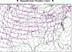
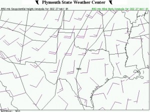
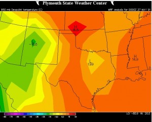
May 27, 1991 A compact upper trough was moving east across the central plains. A cold front dryline intercection was forecated to move across eastern NE. We left Norman and headed north. The CAP looked strong and we made it up to Red Cloud, NE before we called it quits after seeing distant anvils to our north-northeast. A supercell that developed along the front across northeast NE, southeast of Bancroft, NE produced a significant tornado. We could not make it up in time for the tail end supercells and drove back to Norman.
Tornado: 0
Supercell: 0
Chase Partners: David Gold and Mike Magsic
_______________________________________________________________
May 29, 1991. A strong southern stream mid and upper level jet was progged to move east across the TX PNHDL. We decided to chase along the surface dryline east of AMA. As we were traveling west on I-40 we noticed that a supercell had already formed to our northwest. As we got west of Shamrock we could see a distance tornado nearly 30 miles away that was on the ground near Pampa, TX. A second tornadic supercell developed northeast of Plainview, TX and moved northeast towards Goodnight, TX. Our only south option was through the core of the storm and we decided it was too dangerous to punch the core at night. As waited for the storm to pass then drop southeast to catch up with the storm, the storm had weaken and no longer had the potential for a tornado. We spent the night in Childress, TX, since the next day looked even better across southwest OK.
Supercells: 2
Tornado: 1
Chase partners: David Gold, Paul Robinson and Greg Stumpf.
_______________________________________________________________
May 30, 1991. An upper trough was lifting northeast across the southern high plains. This day looked good but a strong CAP and surface heating causing the BL to mix deep allowed the gulf moisture to mix with drier air. We got on a developing dryline storm northwest of Hollis, OK. However the tower sheared apart and we were left with sunny skies. We decided to call it a day by 5 PM and headed back to Norman,OK.
Supercells: 0
Torando: 0
Chase partners: Davide Gold, Paul Robinson and Greg Stumpf.
Did not chase any other time in 1991.
Supercells: 14
Tornadoes: 10

