The March 8, 1992 Storm Chase:
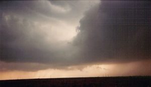
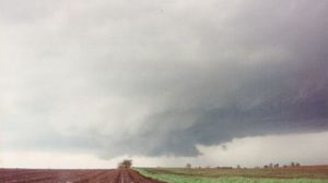
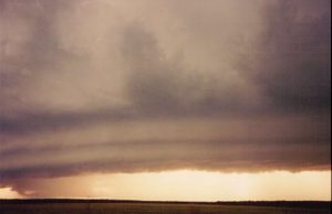
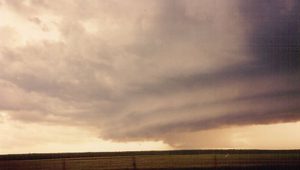
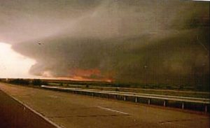
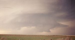
This was an interesting day. An intense upper trough was lifting northeast out NM into the southern high plains. The GOM was not at equilibrium and return flow was only residual gulf moisture. The overall vertical wind shear looked the best along the dryline in western OK but the moisture return was only allowing lower 50 dewpoints to make it back to I-40. Farther south along the dryline west of the Wichita Falls, TX the upper 50 to near 60 dewpoints were progged to return east of the dryline. We had two forecast areas, one along and south of I-40, just west of Clinton where MLCAPES were only around 500 J/KG or farther south where the MLCAPE was closer to 1,000 J/KG. David and I chose the southern target west of Wichita Falls. Other OU chasers stayed closer to home in western OK.
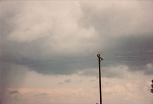
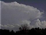
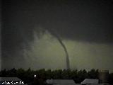
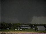
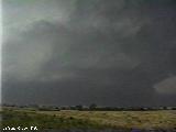
As we drove southwest on I-44 past Lawton we saw a nice anvil streaming off a supercell along the dryline somewhere near Seymour, TX. We kept driving southwest and got on HWY 277 out of Wichita Falls. Several other updrafts began to go up south and north of our target storms. As we got down to Holiday, TX we could see a funnel to our southwest and stopped to watch. Once we got out of the car we could see a cone tornado. It was about 4 miles to our southwest and touched down about 1 mile west of Dundee, TX. After producing the tornado the storm became outflow dominate and a line of storms formed. We got some quarter size hail northeast of Holiday and drove back out ahead of the squall line back to Norman. The other OU chasers had a nice structured storm that formed over SW OK and had a rotating wall cloud but no tornado.
Supercell: 1
Tornado: 1
Chase Partners: David Gold and Paul Robinson.
_______________________________________________________________
The March 17, 1992 Storm Chase:
Left to play the dryline southwest of Vernon, TX. The flow at mid levels was around 40 KTS but there was not enough convergence to break the CAP. This has been my longest bust and a big waste of time during the semester.
Supercell: 0
Tornado: 0
Chase partners: David Gold and Paul Robinson.
_______________________________________________________________
The March 21, 1992 Storm Chase:
Drove down to Southwest, OK, west of Lawton to play the dryline. CAP was strong and moisture return was delayed as only mid to upper 50 degree dewpoints made it north. The turkey towers were going up along the dryline but got torn apart by the shear. Later that evening a supercell storm went up near Cement, OK as we were driving back to Norman.
Supercell: 0
Tornado: 0
Chase partners: David Gold and Paul Robinson.
_______________________________________________________________
The April 16, 1992 Storm Chase:
Chased an outflow boundary that began to move northward as a warm front across southern OK. We targeted a storm northeast of Lawton, then followed it east towards, Chickasha where we got golf ball size hail. The storms formed a line and training storms caused a lot of heavy rainfall from OKC south to Pauls Valley.
Supercell: 1
Tornado: 0
Chased partners: David Gold and Paul Robinson.
______________________________________________________________
The April 18, 1992 Storm Chase:
The 36 hour ETA forecast showed a tornado outbreak would occur across western OK. David went to his Father’s house for Passover and said if the models continued to show an outbreak he would escape from his Dad’s house through a window to make it back up to chase a tornado outbreak. Luckily for David the the 12 hour solution showed a lumbering closed low with enough forcing for a squall line. David got to celebrate Passover with his family. I went out with Gary McMannis and one of his friends. We got on an HP supercell south of Gould, OK. Gary’s friend wanted me drive into an HP supercell. I said hell no and tempers flared. I was about to kick him out of my car. The HP supercell converged into a squall line and we headed back to Norman.
Supercells: 2
Tornado: 0
Chase Partners: Gary McMannis and his friend (forgot his name).
_______________________________________________________________
The May 10, 1992 Storm Chase:
Stronger mid and upper level flow was advecting northeast across western OK well ahead of an intense shortwave trough across the southwestern US. We played the dryline even though moisture return was once again meager. We watch a high based supercell develop east of Erik and we followed it back towards Norman.
Supercell: 1
Tornado: 0
Chased with David Gold and Paul Robinson.
______________________________________________________________
The May 11, 1992 Storm Chase:
This was a major bust for us! We had forecasted to play just east of Ardmore. A bowling ball upper low was moving into southwest OK with a surface low north of DFW that was moving northeast along a stationary front. During our drive down I-35 we saw a nice storm going up southeast of Pauls Valley and we were about to blow it off until it got rock hard convection and a nice wall cloud. So we took off after it, we tried to catch up with it but got slowed down by the damage path southwest of Fittstown. Meanwhile we were missing out on a nice tornadic supercell in our forecast area near Kingston, OK. By the time we got on this storm it was moving into the jungles of east central OK ad was 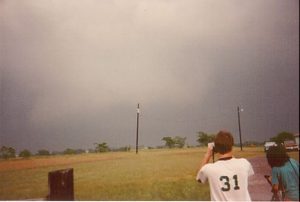
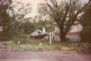 becoming rain-wrapped. Moral of the story is to stick with your original forecast area.
Supercells: 2
Tornado: 0
Chased with: David Gold, Paul Robinson and Rob Satkus.
_____________________________________________________________
The May 31, 1992 Storm Chase:
David and I drove out to the southwest TX PNHLD to play the dryline. We got a nice dryline storm that went up northwest of Muleshoe. The storm had great structure even though it was a bit on the HP side. The constant lightning was causing grass fires southwest of Muleshoe. The storm was moving due south and we followed the storm down towards Enochs where we saw a brief tornado, northwest of town right at sunset. After dark we got caught in flash flooding and Dave’s car started to move off the shoulder of the road and started to move towards a ditch but luckly the car got high centered and we were able to get out of the flooded area. We spent the night in Lubbock!
Supercell: 1
tornado: 1
Chased partners: David Gold.
_____________________________________________________________
The June 1, 1992 Storm Chase:
This looked like a promising day for tornadoes across west TX. However, an MCS developed east of LUB to CDS, and produced an outflow boundary that pushed southward all afternoon. We made it down to Rankin, TX hoping a storm could form on the dryline but it never did. The only storms were severe grungy storms north of the OFB.
Supercell: 0
Tornado: 0
Chased with David Gold
______________________________________________________________
The June 5, 1992 Storm Chase:
Nice southwesterly upper flow of 40 to 50 KTS ahead of an upper level trough across SW KS along a surface dryline. We were so confident of supercells and tornadoes that David and I rented a camcorder. We got to DDC and saw a distance storm to our northwest. I though I had seen a tornado but we were so far away from the storm that I could not prove this. As we got closer to our target storm near Ulysses, other storms began to form to the north and south of our target storm. Eventually we got greeted by an nice shelf cloud. Met up with Chuck Doswell who was also watching the shelf cloud.
Supercell: 1
Tornado: 0
______________________________________________________________
The June 12, 1992 Storm Chase:
A longer wave-length upper trough was moving into the southwester US. 40 KT southwesterly mid level flow was moving northeast across the southern high plains. Our target was along the dryline west of AMA. The dryline only made it into eastern NM. We did get to see a supercell storm near Glen Rio, NM near sunset. We drove back to AMA and spent the night at a KAO camp ground. What a miserable night, the ground was so hard I could not even sleep. Plus there were mosquitos in the tent. The strong winds at 4 AM, due to the LLJ, blew our tent over. We took a shower and the shower area was filthy with a lot of big mosquitos flying around.
Supercell: 1
Torando: 0
______________________________________________________________
The June 13, 1992 Storm Chase:
We targeted southeast CO/western OK PNDL, The better upper flow was shifting north as a down stream upper ridge was amplifying across the eastern plains . During our drive north of AMA we were already seeing an anvil from a storm at 1 PM in the afternoon. There was already a storm over southeast CO! As we approached Walch, CO we sat and watched a nearly stationary supercell. It became HP at times but we saw 2 nice barrel tornadoes from about 10 miles to our north. There were no roads to get to the storm. We ran into Dave Keller who worked up at NSSL who was the only other chaser on our storm. We followed him to DDC and went out to dinner. To our surprise Dave Keller bought us a hotel room after we told him about our horrible camping experience.
Supercell: 1
Tornadoes: 2
Chase Partner: David Gold.
______________________________________________________________
The June 14, 1992 Storm Chase:
The mid-level flow was increasing across the TX PHDL and there was a great dryline across the central TX PNHDL. We drove back down to AMA and sat around east of town waiting for storms to form. However, the CAP increased and prevented any storms from forming. We drove back to Norman and noticed that the moon was disappearing and did not realize it was a lunar eclipse. Once in Norman, we went to the MAP room at OU and knew that the next day was going to be a tornado outbreak. We drove up to NSSL and noticed that Gene Rhoden was still the video lab. Since we knew Gene had a camcorder we asked him to go with us, and we left for central KS at 2 AM. We did not sleep this night!
Supercell: 0
Torando: 0
Chase partner: David Gold
______________________________________________________________
The June 15, 1992 Storm Chase:
On June 14, 1992 my friend Dr. David Gold and I were out storm chasing across the Texas Panhandle. The cap was too strong and no storms fired along the dryline that afternoon and evening. Surprisingly, we both were happy that no deep moist convection had developed late that afternoon or evening since we both knew that the main upper level trough was going to move out into the plains by the next day. We were worried that if thunderstorms had developed over the Texas Panhandle that evening they could have evolve into a large complex of thunderstorms and gobble up all the deep moisture and instability that was in place across the southern plains that evening, and that the atmosphere across central Kansas the next day would not have sufficient moisture or instability for deep moist convection.
Once we got back to home to Norman, OK we looked at the 00Z MRF, Eta and NGM (The limited number of computer models that were available in 1992) in the University of Oklahoma map room. Surprisingly all three models were showing the strong upper level trough over the southwest US lifting northeast into the western high plains. The Gulf of Mexico would be wide open and deep moisture was already in place across central and northern Kansas. We analyzed all the 00z soundings and found quite a bit of instability and deep moisture across most of the southern plains. We were all excited about the environment across north central and central Kansas on June 15th, possessing both strong vertical wind shear and high instability across much of central Kansas along and ahead of a dryline for rotating storms and possible tornadoes. Our initial target area for June 15th was Russel, KS along the dryline. We were so excited about a potential big chase day that we got very little sleep. We woke up at 500 AM, hoping not to see any large complex of thunderstorms developing across the southern plains. The cap held and the only storms were across central Nebraska, moving quickly northeast.
Before leaving we drove up to the National Severe Storm Laboratory where David Gold worked at the time. There we met friend and fellow weather enthusiast Gene Rhoden who also worked at the Lab. Gene had the rest of the day off and decided to join us on our chase. Gene had a video camera and would be able to take video of anything we got to see that day.
At noon we had lunch in Russell, KS and called back to the University of Oklahoma map room, asking if any of the students could read us some noon surface observations, luckily one student agreed and he read us the temperatures, dew point temperature, wind directions and surface pressure for several locations across western and central Kansas. In 1992 we didn’t have laptop computers to download data or WIFI connectivity, so we had to make our morning forecast and call back to the University to see if any students would read us surface observations, look at visible satellite and check for any Watches that may be in effect. From the noon surface observations we thought the dryline and warm front intersection would be east of Oberlin,KS by 300 PM, so we headed northwest to Norton, KS.
We sat around Norton, KS from 400 PM to 500 PM and watched as shallow cumulus clouds popped up and dissipated. Visually it looked like we had a very strong cap in place (a layer of warm air just above the surface that prevents moist parcels of air from rising), so we knew that only a few storms would develop today. We finally spotted some cumulus clouds that were beginning to develop higher in vertical extent to our southeast. The cumulus clouds were developing high enough to classify them as “Towering Cumulus Clouds (TCU)” and they looked to be working on breaking the cap. Though each tower kept on entraining dry air above the surface and would dissipate at the base, eventually enough TCU started growing and tilting over to the east as the mid level winds increased. Over the next half an hour a storm began to form as one dominate Cumulonimbus cloud formed. The convection started to look rock hard with a cauliflower appearance. Our friend Gene Rhoden was taking time lapse video of the first cumulus developing into this rather intense storm. We initially thought the storm was about 20 miles to our southeast but after watching the main tower develop we then determined that we were probably 50 miles from the developing supercell and had to quickly drive southeast to intercept this newly formed supercell thunderstorm.
We found out through listening to the AM radio that the National Weather Service had issued a severe thunderstorm warning Ellis County and that the storm was northwest of Hayes, KS , nearly 60 miles to our southeast. We realized that we would’ve been in much better position if only we had stayed in Russel, KS, where we stopped for lunch earlier in the day. While driving east on Highway 36 towards Phillipsburg, KS we noticed that our supercell thunderstorm had split and that the left mover was racing very fast to the north and northeast. We actually got a wind gusts of 50 to 60 mph and quarter size hail as the left mover passed over us west of Phillipsburg, KS. The strong winds blew a wall of dust across the road dropping visibilities to near zero and caused us to slow down to under 25 MPH for a few moments.
Once we got to Phillipsburg, KS we turned south on to US 183 and headed for Plainville. At the same time we heard reports on the radio of a tornado warning issued for Rooks County for the right moving supercell. Minutes later we entered northern Rooks County and could see the bell shape updraft base to our south. A report on the radio stated that a tornado had struck the community of Plainville, KS. We moved south to the east side of Planville, KS but did not see much in the way of damage. By the time we reached Plainville the storm was already to our northeast. We turned right on state Highway 18 and eventually got east of the tornadic storm. At the town of Luray, KS we turned north onto US highway 281 and traveled north about 15 miles where we ran into the tornado warned storm.
The storm base had become completely rain-wrapped and if there was a tornado it was not visible to us. We stopped south of the storm and watched it move east-northeast across the road in front of us. There was most likely golf ball to baseball size hail wrapping around the storm base along with the heavy rain. We knew we had a high precipitation (HP) supercell, since we could see the striations in the thunderstorm tower along with the precipitation and scud clouds all rotating around the base of the thunderstorm. We were not too thrilled to be observing an HP storm since we expected the vertical wind shear to be strong enough to keep supercells in more of the classic mode with all the precipitation northeast or north of the thunderstorm updrafts. As we sat south of the thunderstorm and watched it cross the highway to our north we could see other motorist drive northward right into the storm. We tried to blink our lights and honk our horn to alert them to the possible dangers of large hail, severe winds and possibly a rain wrapped tornado. Hopefully these drivers that drove into the storm did not receive any injuries. We had our target storm in sight and we wanted to keep east of it, so we dropped back south on US highway 281, then turned east on highway 18 before turning north on a small county road that went to Tipton, KS.
Once we got back east of our HP storm we noticed that a new updraft (storm) had developed east of our HP storm. This new storm developed a low hanging wall cloud as we drove north on the county road toward Tipton. The rain was all well north and northeast of the base of the storm thus we could clearly see the wall cloud. We stopped about 5 miles south of Tipton near the town of Hunter since the county road went west two miles before turning north again, and we did not want to get caught behind the storm or close to the HP storm that was just west to northwest of the new updraft we were observing.
As we watched the new storm to our north the wall cloud got bigger and started developing towards the ground. Then suddenly a funnel cloud dropped towards the surface and then we could see dirt being kicked up at the surface and we yelled out tornado. There was no way to call in the report to the NWS since we did not have a shortwave radio and none of us could afford a cell phone, plus at that time there would not have been any cell phone coverage. The tornado began to grow wider and soon became a large cylinder, what storm chasers call a stove pipe tornado. The contrast from our position got very bad, so we followed the storm due north. Evidently this new classic supercell was slowly being drawn into the monster HP storm just to the northwest.
We took Highway 181 north to Tipton, KS then took a small county road that curved east about 5 miles south of Lake Waconda. A third updraft developed right over the lake or just a mile north of the lake. The entire storm tower was rotating as a rotating wall cloud was rapidly developing. Then suddenly, a tornado formed with a big debris fan around the funnel at the ground. We were within a couple miles of this tornado but noticed that it was getting absorbed into the inflow of the huge HP supercell to our west where the first and second supercells had congealed into one monster storm complex. Suddenly, our nice classic tornado grew into a rather large tornado that quickly became engulfed in precipitation as the storm was absorbed into the big HP to the west. This resulted in the largest supercell thunderstorm I have ever witnessed in my 17 years of chasing. This was a complex of several supercell updrafts that had congealed over time.
We drove east and southeast to get out of the large hail core moving towards us. We decided to set up east of the big complex of supercells. We noticed that the inflow winds into this massive storm picked up to 60 mph with gusts to near 70. It was very difficult to stand outside of the car without getting blown down. As the storm approached us a nice tapered cone tornado sank down from the south side of the supercell complex. The back lighting made for great contrast as the tornado touched down in an empty wheat field about 1 mile west of our position. The tornado moved northeast passing about a mile to our north. We started to get more precipitation so we dropped southeast on Highway 24 from Beloit. It was getting dark as we kept just east of the massive supercell complex. We heard on the radio that a large tornado was reported on the ground west of Beloit, KS right at dusk. We were just in Beloit several minutes ago and didn’t realize how any one could see the tornado that must have been wrapped up by rain and hail.
When we got to US Highway 81 in southern Cloud County, we had to go south a few miles to east of Delphos, KS since the big supercell complex was beginning to move a bit to the southeast. We set up to watch the storm pass about 5 miles to our northwest and north. The lightning was so vivid we had spectacular views of the storm structure and we could even see the wall cloud under the base of the storm. The lightning with this storm was very intense and frequent, and we could not really tell if a tornado was on the ground moving across Highway 81. On the radio we heard reports of a tornado crossing Highway 81 north of Delphos but could not see the tornado from our vantage point.
After watching the storm for another 20 minutes or so we decided to head back for the long drive to Norman. While driving south of Interstate 1-135 we ran across the damage path of a strong tornado that moved across the interstate north of McPherson, KS. During our chase of the north central Kansas supercell complex we did notice a distant supercell to our south and southeast. We were wondering if this storm was producing a tornado or not, evidently it did.
Chased partners: Dr. David Gold and Gene Rhoden.
Supercells: 2, 1 a mega supecell complex. 2. An anticyclonic supercell that moved north across us on our way to our target supercell.
Tornadoes: 4
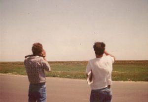
The reason we missed the Plainville, KS tornado. We waited too long watching TCU develop into a storm. Gene and Bill watching the initial TCUs getting sheared over.
Will place a chase route at a later date.
______________________________________________________________
The June 16, 1992 Storm Chase:
We drove down to Wichita, KS to spend the night after the June 15, 1992 chase ended. We got up and drove north to Concordia and stopped by the old NWS WSO in Concordia at Bossar Field on the north side of town. The place was streaming with storm chasers. Beside Dave, Gene and myself we ran into Rich Thompson, Greg Stumpf and Bobby Prentice. A bunch of storm chasers came up from Norman as well. The entire WSO was teaming with storm chasers and I could tell the NWS staff was getting irritated as we were ooohing and ahhhhing about the days set up. SPC had much of central and north central KS under a high risk with a 15 percent hatched tornado probability along the I-135/US 81 corridor from central NE southward across central KS. The more we hyped the day up, the more worried the NWS staff got. The OIC actually updated the forecast to put a 50 percent chance of tornadoes in the zone forecast. I never seen such wording in my entire life. After a lunch at Wendy’s with Bobby Prentice we started heading north of Concordia, a lot of chasers were playing Frisbee along the side of the road as we head north out of town.
As all the CU began to dissipate we began to worry that a rather strong EML was heading northeast across the area. Even getting to Norfolk, NE by 3 PM, we had nothing but blue skies with no CU in site. We joked about how Norfolk was a bee hive of state police waiting to bust anyone going 5 over the speed limit, so we were kind of slow on our way north.
When we got Yankton we could see sharp anvil edges well to our northeast. A trucker came into the truck stop we were at and said he had seen a large tornado pass behind him across I-29 about 2 hours ago across east central SD. Then we heard on the radio about tornadoes moving into southwet MN. We way too late to catch these storms, so we decided to head west to try to get any storms that may go up on the surface dryline/cold front. But the CAP looked too stout so we headed south across central NE. During the evening we saw a distance supercell over western IA near Council Bluffs. A supercell finally went up on the pre-dryline surface trough along the western edge of the deeper moisture. We were wishing we had just hung around farther south as this supercell produced a few picture perfect tornadoes across western IA, northeast of Council Bluffs. This day was total bust for us. I suppose we bought into the SPC outlook hook line and sinker and by the time realize the CAP may be a big problem we headed north way too late and missed several tornadic supercells across east central SD and southwest MN. One of the supercells hit the town of Chandler, MN. Also we left a target area that did pan out before sunset with a nice western IA supercell and a few tornadoes.
Supercell: 1 (distant).
Tornado: 0.
Chase partners: David Gold and Gene Rhoden.
Did not take any pictures. Gene may have some video of the distance supercell over western IA.
I will place an approximate chase map.
______________________________________________________________
The June 18, 1992 Storm Chase:
This day had high CAPE with 35-40 KT zonal flow at mid levels. A nice supercell developed northwest of Kingfisher. The storm was HP but some OU chasers claimed to have seen a tornado northwest of Kingfisher. All I saw was a big rain-wrapped meso and I followed the storm to Cashion, where I got a few golf ball size hail stones.
Supercell: 1
Tornado: 0
Chase partner: Chased alone.
______________________________________________________________
The June 19, 1992 Storm Chase:
High cape and moderate flow across the Panhandle caused SPC to place the TX PNHDL and western OK under a high risk. I went chasing Today with Mike and Rob. We got out to Shamrock and got to see a big HP supercell. The outflow boundary pushed well ahead of the storm and multiple gustnadoes were developing along the outflow boundary. We left the storm in western OK after sunset. While traveling back we had dinner in Clinton, OK. Mike’s car did not start so me and Rob pushed his car and had him put his car in 2nd gear, then his car started. One nice thing about having a standard transmission. When we got back to Norman, some one broke all my car windows as I left my car parked in the CIMS parking lot across the street from the Energy Center.
_______________________________________________________________
The June 29, 1992 Storm Chase:
A nice shortwave was going to lift northeast out of CO into WY. It looked like northwest NE/SW SD had a chance for supercells and torandoes. I left with David and Rich Thompson in meat wagon 2. David was driving and did not realize the car was in a high gear and not in drive. I thought it was just an old car with 3 guys in it and it was normal for the engine to labor along on the interstate. Finally north of Salina, Rich noticed his meat wagon 2 was in gear number 2. Once it got put back in drive, the meat wagon 2 ran well as we got up to north central NE. We saw 2 storm go up to our west at Valentine. There were only two roads that ran west across Cherry county, NE. We chose the northern road and blasted west. However our supercell right moved to the southeast and we had no roads to head south on. We were SOL. Later that evening we stopped in North Platte, NE to stay overnight. We went out to dinner and met Howie and his mobile 5cm radar crew. They were on the southern road and got to see a tornado with our storm!
Supercells: 2
Tornado: 0
Chase partner: David Gold and Rich Thompson.
_____________________________________________________________
The June 30, 1992 Storm Chase:
We left the hotel in North Platte and headed for our target in northwest KS. However, the flow really weakened and we only got to see these weak outflow dominate storms. We decided to head back to Norman, it got really hot and humid as we got to Salina in the evening and the meat wagon 2 did not have AC! The wheat was being cut and it was awful having to have the windows open. Once of the worse drive home after a chase!
Supercells: 0
Tornado: 0
Chase partner: David Gold and Rich Thompson.
______________________________________________________________
The July 2, 1992 Storm Chase:
Was not expecting tornadoes Today across northeast OK. Went northeast of OKC to play southwest supercell but the storm was weak and quickly turned into a line of storms. Went back to Norman.
Supercell: 1
Tornado: 0
Chase partner: Chased alone!
_____________________________________________________________
The September 2, 1992 Storm Chase:
I had a meeting with my advisory during the late afternoon and evening hours, so I could not leave as early as I wanted and missed the Purcell tornado. I did chase the supercell after my meeting was over but the storm had transitioned into an HP supercell.
Supercell: 1
Tornado: 0
Chase partner: Chased alone!
______________________________________________________________
The September 2, 1992 Storm Chase:
High CAPE along with moderate windshear caused high based supercells to develop. I got to see 2 land spout type tornadoes northwest of Chester, OK and then southwest of Chester.
Supercells: 2
Tornado: 2
Chase partner: David Gold and Steve Weyegant.
______________________________________________________________
The September 7, 1992 Storm Chase:
Chased fast moving storms in northwest OK. He got on HP storm near Roll and could not catch up to the storm.
Supercell: 1
Tornado: 0
Chase partner: Chased alone.
_____________________________________________________________
Supercells: 22
Tornadoes: 10
Bill’s count 20.

